Mapping and Monitoring of Agriculture in parts of Sudan using Remote Sensing and GIS
تفاصيل العمل
Business Need:
Satellite Crop Monitoring Technology allows to perform crop
monitoring in different fields, located in different areas,
regions, even countries and on different continents. The
technology's significant advantage is a high automation level
of sown area condition and its interpretation in an interactive
map which can be read by different groups of users.
The identification and crop-area estimates requires multitemporal series of data, as each single image has to be
acquired within a key time-window for optimal target
discrimination.
Inputs Used:
Multi temporal Satellite Images (Resolution-10m)
Area Boundaries
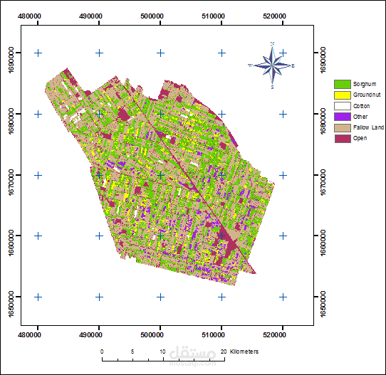
Business Solution:
Satellite images were used to classify the agriculture area
with approach of hybrid classification methodology. The
different types of crops in the irrigated and rain-fed sectors of
the project area mapped and classified to produce maps.
In the next step, these maps were sent for field validation.
After field validation, necessary modification was done and
final maps were created
ملفات مرفقة
بطاقة العمل
| اسم المستقل | Osama E. |
| عدد الإعجابات | 1 |
| عدد المشاهدات | 220 |
| تاريخ الإضافة | |
| تاريخ الإنجاز |